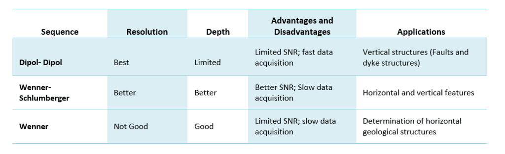
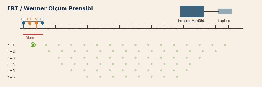
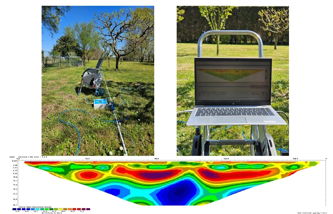
The ERT method allows for more effective interpretation of geological structures by collecting high resolution data. It allows to quickly obtain geological parameters such as possible aquifer points, karstic structures, fractured cracked points, fault discontinuities, salinity ratio, groundwater level along the line.
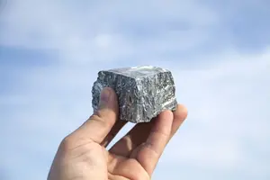
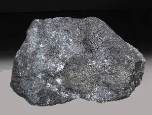
Çinko kendi doğal halinde bulunmaz. Çinko, yayılmış ve masif sülfitlerle (sfalerit vb.) ilişkilidir. Volkanik ortamlarda bakır mineralleriyle, tortul ortamlarda ise kurşunla sıklıkla ilişkilendirilir. Bakır ve nikelin aksine çinko ve sfalerit zayıf iletkendir.
**Keşif için öneriler**
TDEM ve FDEM araştırması: Masif sülfür yatakları çinko açısından zengin olduğunda, bakır sülfürlerle olan ilişki yatağın iletkenliğini artırabilir.
Yerçekimi araştırması : Mineralleşmiş gövdenin fazla kütlesini belirlemek için.
Manyetik araştırma : Jeolojik çevrenin litolojilerini ve yapılarını haritalamak.
Not: Yukarıdaki bilgiler yalnızca bilgilendirme amaçlı verilmiştir. Her arama projesi kendine özgü jeofizik uygulamalarına göre incelenmelidir.
Uranium (U) associated with sandstone
KUM TAŞI İLE İLİŞKİLİ URANYUM’un jeofizik teknikler ile keşfi.
Kumtaşlarıyla ilişkili uranyum yatakları, oksit ve sülfit fasiyesi arasındaki temasta yer alan redoks bölgesine yakınlığıyla bilinir.
**Bölgesel tanımlama**
Manyetizma : Oksidasyonun, sülfit fasiyesindekilerden daha fazla manyetik oksit minerali üretmesi beklenir. Sonuç olarak, manyetik bir araştırma, redoks limitinin haritalandırılmasında etkili bir araçtır.
Spektrometri : Uranyum radyoaktiftir. Buna göre gama spektrometre çalışması olumlu tepkileri tespit eder.
Elektromanyetizma : Grafit rezervleri bazen uyumsuzluklar boyunca yer alır. Bir TDEM araştırması ise pozitif anormalliklerin izlenmesini mümkün kılar.
IP/Rezistivite : Araştırmalar, bu tür yataklarla ilişkili düşük dirençli değişiklikleri haritalamak için kullanılır.
Not: Yukarıdaki bilgiler yalnızca bilgilendirme amaçlı verilmiştir. Her arama projesi kendine özgü jeofizik uygulamalarına göre incelenmelidir.
U - Uranyum
Uranyum doğal halde bulunabilir veya oksitlerle ilişkilendirilebilir. Uranyum çeşitli magmatik, tortul veya hidrotermal jeolojik ortamlarda bulunur. Dünya çapındaki uranyum yatakları, konumlarına göre 14 ana kategoriye ayrılabilir; başlıcaları şunlardır:
Dünya çapında bilinen rezervlerin yaklaşık %33’ünü temsil eden uyumsuzluklarla ilgili rezervler
Güney Avustralya’daki Olympic Dam gibi demir oksitlerle ilişkili birikintiler
Kumtaşı birikintileri
Uranyum radyoaktiftir ve sıklıkla diğer radyoaktif minerallerle ilişkilidir.
**Keşif için öneriler**
Radyometrik araştırma : Yatakları doğrudan tespit etmek ve destekleyici stratigrafik hedefleri haritalandırmak için kullanılır.
Gravite araştırması : Temel ile çökeltiler arasında bir uyumsuzluk bulunduğu göz önüne alındığında, jeolojik birimlerin önemli bir yoğunluk farkı sunabileceğini söyleyebiliriz.
Sismik araştırma : Homojen taban ile tabakalı sedimanlar arasındaki uyumsuzlukların haritasını çıkarmak amacıyla kullanılır.
Manyetik araştırma : Manyetik tabanın haritasını çıkarmak ve tabana oturan havzanın derinliğini belirlemek. Manyetik Araştırma, Uranyumun oksit yataklarında bulunan manyetik minerallerle ilişkili olması durumunda da faydalı olacaktır.
IP/Rezistivite : Yatağın üzerindeki ayrışma bölgelerini haritalamak ve havza derinliğini belirlemek için.
Elektromanyetik araştırma : Çoğunlukla uyumsuzluklarla ilişkilendirilen grafit stratigrafik hedeflerin haritalandırılması için.
Not: Yukarıdaki bilgiler yalnızca bilgilendirme amaçlı verilmiştir. Her arama projesi kendine özgü jeofizik uygulamalarına göre incelenmelidir.
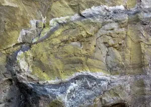
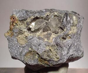
Mississippi Valley Type (MVT) (Zn)
MISSISSIPI VADİSİ TÜRÜ (MVT) İLE İLİŞKİLİ ÇİNKO İÇİN Jeofizik Araştırma Teknikleri
Mississippi Vadisi tipi yataklar, hepsi aynı stratigrafik seviyeyle (genellikle kireçtaşı) ilişkili tabakalı ufuklar ve ilgili kırıklar boyunca yer değiştirme olarak bilinir.
**Detay Arama**
Gravite : Yerçekimi verileri sülfürle zenginleştirilmiş rezervler ve çevredeki kayalar arasındaki yoğunluk kontrastını göstermede etkili bir araç olacaktır.
IP/Rezistivite : IP/R tekniği, Pb-Zn birikintileri gibi zayıf iletkenlerin yerini tespit etmek için etkili bir araçtır.
TDEM : Zayıf iletkenlere duyarlı bir TDEM sistemi, büyük Pb-Zn oluşumlarını haritalamak için kullanılabilir.
Not: Yukarıdaki bilgiler yalnızca bilgilendirme amaçlı verilmiştir. Her arama projesi kendine özgü jeofizik uygulamalarına göre incelenmelidir.
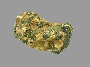
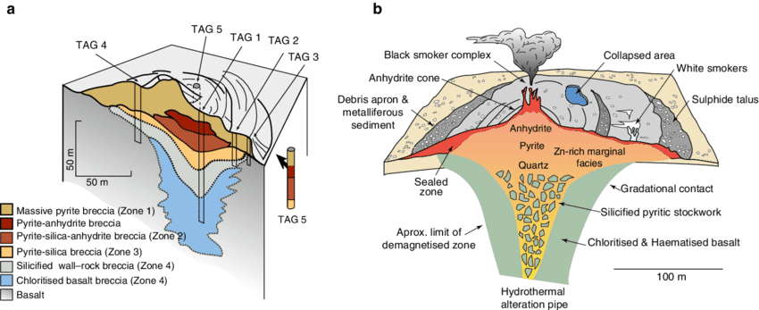
Volcanogenic Massive Sulphide (VMS) (Cu-Zn-Ag-Au)
VOLKANOJENİK YATAKLARLA (VMS) İLİŞKİLİ BAKIR-ÇİNKO için Jeofizik Araştırma
Volkanojenik masif sülfür yatakları, farklı volkanik diziler arasındaki temasta ve çörtlü veya grafitli tortul katmanlar boyunca depolanmalarıyla bilinir.
**Bölgesel tanımlama için**
Gravimetri: Yataklar genellikle çevredeki kayalarla yoğunluk açısından güçlü bir kontrast sağlayabilen masif sülfür mercekleriyle ilişkilidir. Sonuç olarak, mineralize bölgeler izole anomalilere karşılık gelebilir.
Manyetizma: Bu birikintiler, genellikle çevredeki kayalarla manyetik duyarlılık açısından güçlü bir kontrast sağlayan manyetit ve pirotit gibi oksitler içerir. Sonuç olarak, yataklar izole edilmiş güçlü pozitif anormalliklere karşılık gelebilir.
Elektromanyetizma: Eğer yatak bakır açısından zenginse, dolayısıyla çok iletkense, yatak izole edilmiş bir pozitif anormalliğe karşılık gelebilir.
**Detay arama için**
Elektromanyetizma: İyi ve kötü iletkenlere duyarlı geniş bant sistemi tercih edilmelidir.
Gravimetri: Tortu bazen grafitli bir tortuyla kaplanır ve bu da güçlü bir doğrusal iletkene neden olur. Bununla birlikte, masif sülfür yatakları çevredeki kayalarla yoğunluk açısından bir kontrast oluşturacaktır. Sonuç olarak, birikinti iletken boyunca izole edilmiş bir pozitif anormalliğe karşılık gelebilir. Ayrıca mineralize merceklerin tonajına ilişkin bir tahmin de verebilir.
IP/Rezistivite : Yataklar genellikle mineralize merceğin altında yer alan şeritler ve yayılmış sülfitlerden oluşan bir bölge ile ilişkilidir. Sonuç olarak, bir IP/R araştırması bu polarize edilebilir kaynağın yerini bulmayı kolaylaştıracaktır.
Not: Yukarıdaki bilgiler yalnızca bilgilendirme amaçlı verilmiştir. Her arama projesi kendine özgü jeofizik uygulamalarına göre incelenmelidir.
Lateritic Soil (Ni)
LATERİT YATAKLARI İLE İLİŞKİLİ NİKEL İÇİN Jeofizik ile Arama Lateritik nikel yatakları, yüzeye yakın, hafif eğimli, tablo şeklinde, çok yüksek tonajlı, çok düşük dereceli olarak bilinir. Küresel nikel üretiminin %73’ünü temsil ediyorlar ve gelecekte nikelin ana kaynağı olacaklar. Ultramafik kayaçlar üzerinde oluşan altere olmuş bölgeleri temsil ederler.
İki tip lateritik nikel cevheri ayırt edilebilir:
Magnezyum ve silikanın yoğun liçinden dolayı demir oksit bakımından zenginleşen limonit oksit türü. Götit içerisinde %1-2 oranında nikel içerir.
Oksit bölgesinin altında oluşan silika saprolit türü. Nikelin tamamı oksitlenmiş alandan süzülür.
**Bölgesel tanımlama**
Manyetizma: Oksit örtüsünün altında bulunan ultramafik birimler genellikle gömülü ve gizlidir. Genellikle çevredeki kayalardan daha güçlü bir manyetik duyarlılığa sahiptirler. Sonuç olarak, havadan yapılan bir araştırma ultramafik kayaları regolit maskesi aracılığıyla haritalandırabilir.
Spektrometri: Lateritik kabuğun iyi gelişmiş olduğu (Fe-Ni-Co açısından zengin) sektörler yüksek Uranyum ve eThoryum içeriğine sahiptir. Büyük bir bölgesel anomaliyi tanıyarak lateritik kabuğu tespit etmek için havadan yapılan bir araştırma uygun olabilir.
Not: Yukarıdaki bilgiler yalnızca bilgilendirme amaçlı verilmiştir. Her arama projesi kendine özgü jeofizik uygulamalarına göre incelenmelidir.
Skarn (Cu, Zn, Au, Fe, Mo)
SKARNLARLA İLİŞKİLİ BAKIR-ÇİNKO-ALTIN-DEMİR-MOLİBDENİM İÇİN Jeofizik ve Araştırma
Skarnlar bölgesel veya kontakt metamorfizma sırasında oluşabilir ve magmatik, metamorfik, meteorik veya deniz kökenli sıvıları içeren çeşitli metasomatik süreçler oluşturabilir.
**Bölgesel tanımlama**
Gravimetri: Hemen hemen tüm skarnlar çevredeki kayalardan daha yoğundur ve bu nedenle gravite anomalileri oluştururlar. Bu özellikle demirle zenginleştirilmiş skarnlarda belirgindir. Sonuç olarak, anket pozitif bir yerçekimi anomalisi ortaya koyuyor.
Manyetizma: Demir açısından zengin bazı büyük skarnlar, yüksek sıcaklıkta manyetit veya pirotit içerir. Sonuç olarak pozitif bir manyetik anomali gösterirler.
IP/Rezistivite: Skarnlardaki polarizasyon, sülfitlerin yayılması ve karbonun yeniden dağılımını içeren karbonat kayalarının metasomatizması ile üretilir. Sonuç olarak, polarize edilebilir kaynağın sülfürlerle ilişkili olduğundan emin olmak için IP/R verilerinin dikkatli bir şekilde yorumlanması gerekir.
Spektrometri: Bazı skarnlar uranyum ve toryum içerir. Sonuç olarak skarnlar havadan veya karadan yapılan radyometrik araştırmalarla tespit edilebilmektedir.
Sismik: Skarn ortamı sismik bir süreksizlik yaratır.
Not: Yukarıdaki bilgiler yalnızca bilgilendirme amaçlı verilmiştir. Her arama projesi kendine özgü jeofizik uygulamalarına göre incelenmelidir.
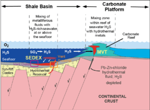
SEDEX (Pb-Zn)
SEDEX İLE İLİŞKİLİ ÇİNKO için jeofizik ve keşif.
Yataklar, mermer zonları boyunca tablo şeklindeki sülfitlerin konsantrasyonu olarak biliniyor. Hedefler genellikle alt temasın yakınında bulunur.
**Bölgesel tanımlama**
Gravimetri: Sülfitler bakımından zenginleştirilmiş mermer tabakaları genellikle çevredeki kayalarla yoğunluk açısından iyi bir fark gösterir. Sonuç olarak, yerçekimi araştırması en etkili araçlardan biridir.
Elektromanyetizma: Çinko sülfürler zayıf iletkenlerdir. Ancak bu tip birikimlerin haritalanması için yüksek frekanslı ölçüm yapabilen bir EM sistemi tavsiye edilmektedir.
Manyetizma: Taban kaya ile farklılık bölgesel araştırmalarda açıkça görülmektedir.
IP/Rezistivite: Düşük özdirenç değerleri bu tür rezervlerle ilişkilidir.
Not: Yukarıdaki bilgiler yalnızca bilgilendirme amaçlı verilmiştir. Her arama projesi kendine özgü jeofizik uygulamalarına göre incelenmelidir.
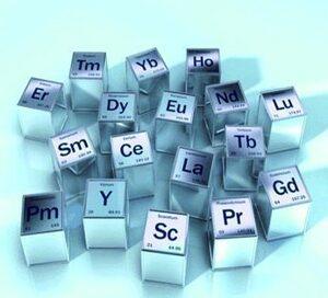
Nadir Topraklar Elementleri
Nadir Toprak elementleri, genellikle alkali magmatik kayaçlar ve karbonatitlerle birlikte bulunan 17 elementi içerir. İsimlerine rağmen, Nadir Toprak elementleri (seryum, itriyum, vb.) genellikle Dünya’nın kabuğunda bol miktarda bulunur ve seryum, en bol bulunan 25. elementtir. Bununla birlikte, jeo kimyasal özellikleri nedeniyle, Nadir Toprak elementleri genel olarak dağınık halde bulunur ve çoğu zaman ekonomik olarak sömürülebilir konsantrasyonlarda bulunmaz; bu nedenle Nadir Toprak elementleri olarak bilinirler.
**NADİR TOPRAKLARIN keşfi için öneriler**
İlk adım buldukları ortamı tanımlamaktır.
Drone manyetik ve gravite araştırmaları: Ana kayaların yerini belirlemek için. Birçok karbonatit alkalin kayalarla çevrelendiğinden, genellikle düşük bir yerçekimi ile birleştirilmiş ve yüksek bir yerçekimi ile çevrelenmiş izole edilmiş dairesel anomalilerin bir ifadesini gösterirler.
Radyometrik araştırma : K, Th ve U izlerini içeren litolojilerin haritalandırılmasında kullanışlıdır.
Not: Yukarıdaki bilgiler yalnızca bilgilendirme amaçlı verilmiştir. Her arama projesi kendine özgü jeofizik uygulamalarına göre incelenmelidir.
PGE - Platin
Platin element grubu (PGE), diğerlerinin yanı sıra paladyum, iridyum, osmiyum ve rodyumdan oluşur. PGE’ler genellikle Ni-Cu sülfürler ve kromit yataklarıyla ilişkili olmalarına rağmen doğal olabilir. Sülfürlerle ilişkili PGE’ler oldukça iletkendir.
**Keşif için öneriler**
Manyetik araştırma : Cevherleşmeyi barındıran ultramafik ufukların ve onunla ilişkili manyetik minerallerin yerini tespit etmek.
TDEM ve FDEM araştırmaları : Büyük sülfür yataklarının yerini tespit etmek için.
IP/Rezistivite araştırması : Yayılan sülfür kümelerinin yerini tespit etmek için.
Not: Yukarıdaki bilgiler yalnızca bilgilendirme amaçlı verilmiştir. Her arama projesi kendine özgü jeofizik uygulamalarına göre incelenmelidir.
Pegmatit mineral lityumun en büyük kaynağıdır ve en ticari kaynak Spodümen dir.
Spodümen mineralleri nispeten nadir olmakla birlikte pegmatitlerin içinde büyük minerallere dönüşebilirler. Sonuç olarak, araştırmalarda mineralin kendisinden ziyade dayk yapılarıyla ilişkili pegmatitlere odaklanılır. Bir dayk yapısı, her biri kalınlığı 2 ila 30 metre arasında değişen birkaç setten oluşan ve 5 kilometre uzunluğundaki bir koridoru kaplayabilir.
**Bölgesel tanımlama***
Manyetizma ve Gravimetri: Bölgesel plütonik kayaları tanımlamak.
**Detay arama**
Manyetik çalışma: Yoğun dayk yapılarının keşfi için.
Not: Yukarıdaki bilgiler yalnızca bilgilendirme amaçlı verilmiştir. Her arama projesi kendine özgü jeofizik uygulamalarına göre incelenmelidir.
Iron Oxide (Fe-Cu-Au-Co-U-REE)
DEMİR-BAKIR-ALTIN-KOBALT-URANYUM-DEMİR OKSİTLERLE İLİŞKİLİ NADİR TOPRAKLAR için jeofizik ile keşif edilen Demir oksit yatakları, yüksek demir konsantrasyonu ve farklı metallerle ilişkileriyle bilinir.
Dünya çapında üç büyük farklı sınıfa ayrılabilirler:
Demir-bakır-altın-kobalt: Oksitlerle ilişkili;
Demir-bakır-altın-kobalt: Sülfitler ve oksitlerle ilişkilidir
Gravimetri: Hematit ve manyetit bakımından zengin alanlar, yan kayaçlarla farklı yoğunluk kontrastı sunar. Sonuç olarak potansiyel rezerv alanları pozitif bir yerçekimi anomalisi gösterir.
Manyetizma: Hematit ve manyetit bakımından zengin alanlar, çevredeki kayalarla manyetik duyarlılık açısından bir kontrast oluşturur. Manyetik çalışmalarda rezerv alanları pozitif bir manyetik anomali sergimektedir.
” Dünyada çoğu keşfedilen demir oksit sahalarının hemen hepsinde üst üste bindirilmiş manyetik ve gravite çalışmaları ile keşifler yapılmıştır. “
**Detay arama**
Spektrometre: Potasik alterasyon sıklıkla yatağı çevreleyen kayalarla ilişkilidir. K, U ve Th için spektrometre çalışmaları pozitif bir anomali gösterir.
Gravimetri: Hematit ve manyetit bakımından zengin alanlar, çevredeki kayalarla genelde güzel bir yoğunluk farklı gösterir.
Not: Yukarıdaki bilgiler yalnızca bilgilendirme amaçlı verilmiştir. Her arama projesi kendine özgü jeofizik uygulamalarına göre incelenmelidir.
Ni - Nikel
Nikel doğada doğal olarak bulunmaz. Genellikle manyetik ortamlarda yayılmış veya masif sülfitlerle (pentlandit vb.) veya lateritlerdeki oksit mineralleriyle ilişkilidir. Nikel sülfürler güçlü iletken veya süper iletkendir. Çoğunlukla pirotit gibi manyetik minerallerle ilişkilidirler.
**Keşif için öneriler**
Manyetik araştırma : Cevherleşmeyi barındıran ultramafik rezerv alanlarının ve onunla ilişkili manyetik minerallerin yerini tespit etmek için idealdir.
TDEM ve FDEM araştırmaları : Büyük sülfür yataklarının yerini tespit etmek için tercih edilir.
IP/Rezistivite araştırması : Yayılan sülfür kümelerinin yayılımı ve derinliğini tespit etmek için tercih edilmektedir.
Not: Yukarıdaki bilgiler yalnızca bilgilendirme amaçlı verilmiştir. Her arama projesi kendine özgü jeofizik uygulamalarına göre incelenmelidir.
Mo - Molibden
Molibden doğada doğal halinde bulunmaz, bunun yerine molibdenit veya wulfenit gibi oksidasyon minerallerinde bulunur. Molibden doğrudan ürün olarak çıkarılır, ancak aynı zamanda bakır ve tungsten madenciliği sırasında yan ürün olarak da geri kazanılır. Keşif, mineralin kendisini aramak yerine, ana kaya plütonlara odaklanıyor.
**Keşif için öneriler**
Drone manyetik araştırma : Plütonların yerini belirlemek için.
IP/Rezistivite araştırması : İlgili yayılmış sülfürlerin yerini tespit etmek için.
Spektrometrik araştırma : Bu yatakların oluşumuyla ilişkili potasik değişimi açıklığa kavuşturmak için.
Not: Yukarıdaki bilgiler yalnızca bilgilendirme amaçlı verilmiştir. Her arama projesi kendine özgü jeofizik uygulamalarına göre incelenmelidir.
Li - Lityum
Lityum doğada doğal haliyle bulunmaz. Dünyadaki lityum üretiminin çoğu aşağıdakilerden geliyor:
Mineralizasyonun genellikle tuzlu suyla ilişkili olduğu tuz tavaları veya büyük tuz gölleri.
Plütonlarla ilişkili pegmatit mineralleri. Granitik pegmatit, lityum mineralleri için ana kaynak kayadır ve spodümen ana ticari mineraldir.
BRINES’te lityum arama önerileri
SAGTech Jeofizik, evaporit ortamlarda lityum açısından zengin tuzlu su birikintileri oluştuğundan şunları önermektedir:
IP/Rezistivite araştırması : Genellikle çevredeki kayalardan daha az dirençli olan pegmatitik daykların yerini tespit etmek için.
Manyetik araştırma : Daykların yerleşmiş olabileceği plütonların ve çatlaklı yapıların yerini tespit etmek için.
Not: Yukarıdaki bilgiler yalnızca bilgilendirme amaçlı verilmiştir. Her arama projesi kendine özgü jeofizik uygulamalarına göre incelenmelidir.
Komatiit (Ni-Cu-PGE)
KOMATİİTLERLE İLİŞKİLİ NİKEL-BAKIR-PLATIYUM GRUBU ELEMENTLERİNİN JEOFİZİĞİ VE ARAŞTIRILMASI
Komatiitler, alt dokanağın yakınında yer alan masif sülfür mercekleriyle ilişkileriyle bilinir.
**Bölgesel tanımlama**
Manyetizma: Komatiitik akışların belirgin bir manyetik imzası vardır. Manyetik araştırma, doğrusal pozitif manyetik izlerin haritalandırılmasında etkili bir araçtır.
Elektromanyetizma: Havadaki sistemler büyük, yüksek iletkenliğe sahip cisimleri tespit etmek için kullanılabilir.
**Detay arama**
Elektromanyetizma: Masif sülfür mercekleri çok iletkendir. EM sistemleri B alanını “zamanında” ve “kapalı zamanda” ölçebilir ve akışların tabanındaki zenginleşmeleri tespit etmek için etkili araçlardır.
Gravimetri: Masif sülfür mercekleri genellikle çevredeki kayalarla önemli bir yoğunluk farkı sunar. Ancak çevredeki kayalar komatitler olduğundan, bu fark daha az belirgindir. Ek olarak, yerçekimi araştırması mineralize mercekler için tonaj tahmini sağlayabilir.
IP/Rezistivite: Saçılmış sülfitler sıklıkla masif sülfit merceklerinin üzerinde bulunur. IP/R araştırması merceğin kendisinden daha büyük bir alanı hedeflemede daha etkilidir.
Not: Yukarıdaki bilgiler yalnızca bilgilendirme amaçlı verilmiştir. Her arama projesi kendine özgü jeofizik uygulamalarına göre incelenmelidir.
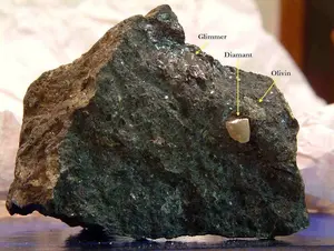
Kimberlite (Diamond)
KİMBERLİT İLE İLİŞKİLİ ELMAS için Jeofizik ve Keşif
Kimberlitler, elmas çökelme ortamıyla olan ilişkileriyle bilinir.
**Bölgesel tanımlama**
Manyetizma: Kimberlit bacaları genellikle manyetik duyarlılık açısından çevredeki kayalarla bir kontrast oluşturur. Belirgin bir dairesel manyetik anomali gösterirler.
Elektromanyetizma: Buzul olmayan arazide, kimberlit bacaları kil minerali değişiminden oluşan bir örtü üretme eğilimindedir. Dirençli bir ortamda bu değiştirilmiş bölge yüzeye yakın bir elektromanyetik anormallik oluşturmalıdır. Bu manyetik bir anormallikle örtüşebilir.
**Detay arama**
Spektral IP (SIP) : Kimberlit bacaları, çevredeki kayalarla ilişkili olabilen veya olmayabilen egzotik mineraller içerir. Sonuç olarak, spektral IP, uygun kimberlitleri kısır olabileceklerden ayırmak için bir ayrım aracı olabilir. Spektral IP, her ikisi de kimberlitlerle ilişkili olan manyetit ve arjilit minerallerine karşı hassastır. Spektral IP, manyetitin (kısa zaman sabiti) ve piarjilitik minerallerin (uzun zaman sabiti) IP imzasını ayırt etmeyi mümkün kılacaktır.
Spektrometri: Kimberlit bacaları radyoaktif olabilecek egzotik mineraller içerir. Bu nedenle spektrometri çok etkili bir araç haline gelir. Magmatik ortamlardaki Kimberlit bacaları çevredeki ortama göre daha az radyoaktif olabilir.
Gravimetri: Magmatik ortamlardaki Kimberlit bacaları negatif yerçekimi anomalileri üretir çünkü kimberlitler tipik magmatik kayalardan daha az yoğundur.
Rezistivite: Kimberlit bacalarının alterasyon örtüsünün sınırları ve derinliği, dirençli bir çevre ortamındaki özdirenç ile haritalanabilir.
Manyetizma: Manyetik kimberlit bacalarının (örneğin, kimberlit bacalarının eşiği veya daykı) temas noktalarını haritalamak için manyetik bir araştırma kullanılabilir.
FDEM: Dirençli bir ortamda kimberlit bacaları üzerindeki alterasyon yönünü hızlı bir şekilde haritalamak ve alterasyon derinliğini haritalamak için bir FDEM araştırması kullanılabilir.
Not: Yukarıdaki bilgiler yalnızca bilgilendirme amaçlı verilmiştir. Her arama projesi kendine özgü jeofizik uygulamalarına göre incelenmelidir.
Intrusive Alkaline (Au)
ALKALİ GİRİŞİMLERLE İLİŞKİLİ ALTIN için jeofizik teknikler ile keşfi;
Alkali intrüziflerle ilgili maden yatakları, yayılmış sülfürlerle ilişkili düşük dereceli altın potansiyelleri ile bilinir. Mineralizasyon genellikle intrüzif içinde veya ana kayaçlarda stok-work içinde yoğunlaşmıştır.
**Bölgesel tanınmlama**
Potansiyel olarak mineralleşmiş cisimlerin yerini tespit etmek için bölgesel keşif araştırmaları gereklidir.
Gravimetri: Plütonlar genellikle kendilerini çevreleyen kayalar kadar yoğun değildir. Gravite çalışmalarında rezerv alanlarının anomalisi, büyük bir pozitif bölgesel anomali içindeki ayrı bir negatif yerçekimi anomalisine karşılık gelir.
Manyetizma: Manyetit ve pirotit, girişimsel kontakt metamorfizma bölgesi boyunca kristalleşir. Rezerv alanları sıklıkla silindirik pozitif manyetik anomaliye karşılık gelir.
**Detay arama*
Manyetizma: Rezerv kayalarla ilişkili kırılma desenleri genellikle çevredeki kayalardan farklıdır. Rezerv kayaların rezerv noktaları, homojenliği ve yapısı ayrıntılı olarak haritalanabilmektedir.
IP/Rezistivite: Saçılmış sülfitler mineralize bölgelerle ilişkilidir. IP/R bu nedenle sülfürleri tespit edebilir. Ek olarak özdirenç değerleri, kontaklar ve faylar gibi yapıların haritalandırılmasında kullanışlıdır.
Not: Yukarıdaki bilgiler yalnızca bilgilendirme amaçlı verilmiştir. Her arama projesi kendine özgü jeofizik uygulamalarına göre incelenmelidir.
Epitermal Yataklar (Au-Ag-Cu)
Epitermal yataklarıyla ilişkili ALTIN-GÜMÜŞ VEYA BAKIR-ALTIN için jeofizik ve keşif
Epitermal yataklar, bölgesel genişleme faylarının geniş bölgeleri ve bunların yan kuruluşlarıyla ilişkilidir. Ayrıca bölgesel ölçekte kırılgan kırılma ağlarıyla da yakından ilişkili olabilirler.
**Bölgesel tanımlama**
Manyetizma: Damar yatakları, stratigrafik dizideki süreksizlikleri ve müdahaleci kontakları işaret eden faylar ve kırıklarla ilişkilidir. Bölgesel bir havadan manyetik araştırma, büyük ölçekli haritalamaya destek sağlar.
**Detay arama**
FDEM: Büyük kırıklar ve faylar boyunca meydana gelen erozyon, örtü tabakasının kalınlığında süreksizliklere neden olur. Bu değişikliklere duyarlı bir FDEM araştırması sıklıkla kullanılır.
IP/Rezistivite: Damarlarla sıklıkla ilişkilendirilen yayılmış sülfit haleleri, IP/R araştırmasını etkili kılan polarize edilebilir bir kaynak sunar. Kuvars damarlarının konsantrasyonları yüksek direnç özellikleri olarak tanımlanabilir.
Manyetizma: Ayrıntılı drone manyetik araştırmaları, stratigrafik diziyi kesen fayların ve kırıkların yerinin belirlenmesi ve müdahaleci temasların haritalanması için ek bilgi sağlayabilir.
Not: Yukarıdaki bilgiler yalnızca bilgilendirme amaçlı verilmiştir. Her arama projesi kendine özgü jeofizik uygulamalarına göre incelenmelidir.
Stratified iron formation (Fe)
YATAKLANMIŞ DEMİR OLUŞUMLARI (BIF) İLE İLİŞKİLİ DEMİR İÇİN Jeofizik Araştırmalar
Katmanlı demir oluşumlarıyla ilişkili yataklar, yüksek demir konsantrasyonlarıyla bilinir. Çökelme ortamına bağlı olarak sülfit, karbonat veya oksit fasiyesinde olabilirler. Dünya çapında iki ana sınıfa ayrılabilirler:
Üstün tip oksit fasiyes demir oluşumu
Algoma tipi sülfit-karbonat demir oluşumu
**Bölgesel tanınmlama**
Manyetizma : Üstün oksit fasiyes tipi için manyetit ve belirli bir dereceye kadar pirotit güçlü manyetik kontrastlar üretebilir. Demir oluşumlarının haritalandırılmasında en iyi araç havadan (drone manyetik) yapılan yüksek çözünürlüklü manyetik araştırmaladır.
Elektromanyetizma: Algoma tipi için grafit bazen sülfit fasiyesi ile ilişkilendirilir. Çalışma sonucu verilerde pozitif EM anomalileri muhtemel rezerv alanlarını işaret edebilir.
Gravimetri: Tabakalı demir oluşumları komşu kayalarla yoğunluk açısından güçlü bir kontrast oluşturuyor. Bölgesel bir mikro gravite araştırması pozitif bir yerçekimi anomalisi ortaya koyacaktır.
**Detay arama**
Sondaj günlüğü kaydı: Manyetik duyarlılık ölçümleri, demir açısından daha zengin olan alanları belirlemek için kullanılabilir.
Gravimetri : Katmanlı demir oluşumları, komşu kayalarla yoğunluk bakımından güçlü bir kontrast oluşturur. Bölgesel bir araştırma, demir rezervinin yoğun olduğu alanlarda pozitif bir yerçekimi anomalisi ortaya çıkarır. Bu aynı zamanda mineralize merceklerin tonajının tahmin edilmesine de olanak sağlayabilir.
TDEM ve FDEM araştırmaları : Demir sülfür zenginleşme bölgelerinin belirlenmesi amacıyla tercih edilebilir.
Not: Yukarıdaki bilgiler yalnızca bilgilendirme amaçlı verilmiştir. Her arama projesi kendine özgü jeofizik uygulamalarına göre incelenmelidir.
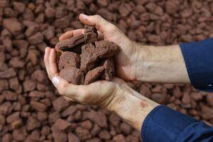
Fe - Demir
Tabakalı demir oluşumları, baskın demir minerallerine göre dört ana fasiyese bölünebilen tortul kayaçlardır. Fasiyes zonalitesi sığdan derin sulu çökelme ortamına kadar değişmektedir. Oksitten silikata, karbonata, sülfüre doğru gidiyor. Grafit genellikle sülfürlü fazlarla ilişkilendirilir. Çoğu ekonomik yatak, Superior tipi olarak bilinen oksit fasiyesleriyle ilişkilidir. Diğerleri Algoma olarak bilinen oksit-silikat-sülfit fasiyesi ile ilişkilidir.
**SUPERIOR tipi için keşif önerileri**
Demir oksit mineralleri Labrador Çukuru’ndakiler gibi manyetiktir.
Manyetik araştırma : Stratigrafik alanları netleştirmek için. (Özellikle havadan manyetik araştırma, Dünya’daki ve Türkiye’deki son keşiflerde etkisini göstermiştir.)
Sondaj çalışması : Sülfür zenginleşme bölgelerini tanımlamak için.
**ALGOMA tipi için keşif önerileri**
Demir sülfit mineralleri iletkendir.
Manyetik araştırma : Pirit manyetik bir mineral olmadığından, manyetik araştırma stratigrafik manyetik yönelimler boyunca düşük manyetik tepkilerini tanımlamaya yardımcı olur.
TDEM ve FDEM araştırmaları : Demir sülfür zenginleşme bölgelerinin belirlenmesi amacıyla tercih edilen yöntemlerdir.
Not: Yukarıdaki bilgiler yalnızca bilgilendirme amaçlı verilmiştir. Her arama projesi kendine özgü jeofizik uygulamalarına göre incelenmelidir.
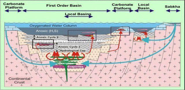
Evaporites, Salt Waters and Salt Lakes
TUZLU SULAR VE TUZ GÖLLERİ İLE İLİŞKİLİ LİTYUMUN Jeofizik ve Keşfi
Dünyadaki lityum üretiminin büyük bir kısmı, maaş olarak bilinen tuzlu sulardan ve tuz göllerinden gelmektedir.
**Bölgesel tanınmlama**
Gravite: Araştırmalar ana kayanın derinliğinin belirlenmesine yardımcı olabilir, böylece akifer sisteminin kapsamı belirlenebilir ve havzanın hacmi ve gözenekliliği tahmin edilebilir.
IP/Rezisitivite: Bir IP/R araştırması, tuzlu su ufuklarının belirlenmesine yardımcı olabilir.
Sismik: Tuzlu suların birikmesi genellikle yüksek açılı yamaçlarla sınırlıdır. Sismik araştırma, alttaki ana kayanın haritasını çıkarmak için etkili bir araçtır. Aynı zamanda yapısal tuzakların yerini tespit etmek için de yararlı bir araçtır.
Not: Yukarıdaki bilgiler yalnızca bilgilendirme amaçlı verilmiştir. Her arama projesi kendine özgü jeofizik uygulamalarına göre incelenmelidir.
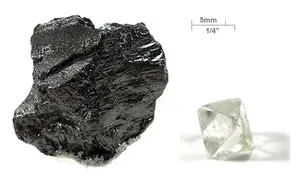
Diamond
Elmas doğal formda, genellikle kimberlit bacası veya ikincil olarak aşınmış kimberlit bacalarından türeyen alüvyon birikintilerinde bulunur. Bir elmas, yüzeyin 100 km’den daha derin derinliklerinde, yüksek sıcaklık ve basınçta karbondan oluşur. En sert mineraldir. Genellikle kimberlit bacalarının içindeki yoğun minerallerle ilişkilidir. Bu nedenle elmas aramaları kimberlit bacalarının bulunmasına odaklanıyor. Bir kimberlitin jeofiziksel imzası, bulunduğu ortama bağlı olarak önemli ölçüde değişebilir. Örneğin, değiştirilmiş kimberlitler magmatik bir ortamda iletken olabilir. Ayrışma örtüsü buzullar tarafından aşınmışsa, kimberlitler tortul ortamda dirençli olabilir.
**Keşif için öneriler**
Manyetik araştırma : Dairesel anormallikleri bulmak için.
Havadan EM araştırması : Bu araştırmalar keşifte potansiyel olarak kimberlit bacası olabilecek iletken çizgileri belirlemek için kullanılır.
Zemin EM araştırması : TDEM ve FDEM araştırmaları, boruların üzerindeki iletken hava koşulları katmanlarını tespit etmek için kullanılır.
Yerçekimi araştırması : Çevrelerine bağlı olarak pozitif veya negatif olabilen, kimberlit bacaları ilişkili izole pozitif dairesel anormalliklerin yerini tespit etmek.
Spektrometri araştırması : İlgili radyoaktif mineralleri tespit etmek için.
Not: Yukarıdaki bilgiler yalnızca bilgilendirme amaçlı verilmiştir. Her arama projesi kendine özgü jeofizik uygulamalarına göre incelenmelidir.
Porfir Bakır (Cu-Mo / Cu-Au)
PORFİRİK BAKIR İLE İLİŞKİLİ BAKIR-MOLİBDEN-ALTIN için jeofizik ve keşif
Bakır tipi yataklar, porfiritik dokuya sahip kuvars diyorit ve monzonitlerdeki geniş yayılmış sülfit bölgeleriyle ilişkili düşük tenörlü olmaları ile bilinir. Cevherleşme genellikle intrüsiflerin içindeki stoklarda veya çevredeki kayalarda yoğunlaşmıştır.
**Bölgesel tanımlama**
Potansiyel olarak cevherleşmeye ev sahipliği yapan kaynak kütlelerin yerini tespit etmek için bölgesel bir keşif araştırması yapılması gerekmektedir.
Gravimetri: Profirik bakır cevheri genellikle çevresindeki kayalar kadar yoğun değildir. İntruzifler sıklıkla pozitif bölgesel anomali içindeki negatif yerçekimi anomalilerine karşılık gelir.
Manyetizma: Manyetit ve pirotit, kontakt metamorfizma zonu boyunca kristalleşir. Toplanan veriler genellikle pozitif silindirik manyetik anomaliyle çakışır.
**Detay arama**
IP/Rezistivite: Saçınımlı sülfit zonunda cevherleşme yaygındır. Alan polarize edilebilir ve bir IP/R araştırması ile haritası çıkarılabilir.
Spektrometri: Büyük ölçekli bir alterasyon bölgesi porfir yataklarıyla ilişkilidir. Mineraloji çekirdekten dışarıya doğru değişir. Spektrometri çalışması, mineral izlerini ayırt etmek için sıklıkla bir araç olarak kullanılır.
Not: Yukarıdaki bilgiler yalnızca bilgilendirme amaçlı verilmiştir. Her arama projesi kendine özgü jeofizik uygulamalarına göre incelenmelidir.
Cu - Bakır
Bakır, oksitlerle (bornit vb.), yayılmış veya masif sülfürlerle (kalkopirit vb.) birlikte doğal halinde bulunabilir; ikinci tür, en çok karşılaşılan ticari yataktır.
Doğal bakır ve bakır sülfürler genellikle oldukça iletkendir. Bakır oksitler genellikle manyetiktir ve manyetit veya pirotit gibi diğer manyetik minerallerle ilişkilidir.
TDEM ve FDEM araştırmaları : Bakır açısından zengin masif sülfür kümelerinin araştırılması için.
Gravimetri : İletken sülfitlere atfedilebilecek fazla kütleyi tespit etmek için.
Drone manyetik araştırma : Bakır oksit yataklarıyla ilişkili stratigrafik ufukların veya yapısal çizgilerin yerini belirlemek için.
Not: Yukarıdaki bilgiler yalnızca bilgilendirme amaçlı verilmiştir. Her arama projesi kendine özgü jeofizik uygulamalarına göre incelenmelidir.
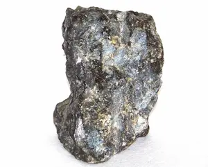
Cr - Krom
Krom, genellikle kromit olmak üzere oksit mineralleriyle ilişkilidir.
İki tür kromit yatağı vardır:
Kromitçe zengin yataklardan oluşan tabakalı yataklar.
Silindirik gövdelerden veya düzensiz şekillerden oluşan kümeler halinde birikintiler.
Kromit sıklıkla diğer manyetik minerallerle (manyetit, pirotit, pentlandit) ilişkilidir.
**Keşif için öneriler**
Havadan veya yerden manyetik araştırma : Uygun alanları ve jeolojik sınırları belirlemek için.
IP/Rezistivite araştırması : Belirli koşullar altında polarize olabilen manyetit gibi ilişkili minerallerin araştırılması için.
Not: Yukarıdaki bilgiler yalnızca bilgilendirme amaçlı verilmiştir. Her arama projesi kendine özgü jeofizik uygulamalarına göre incelenmelidir.
Yataklı Magmatik Kompleksler (Cr-Co-Ni-Cu-PGE)
YATAKLI ULTRAMAFİK GİRİŞİMLİLERLE İLİŞKİLİ KROM-KOBALT-NİKEL-BAKIR-PGE için Jeofizik ve Araştırma Katmanlı
girişimler genellikle yüksek konsantrasyonlarda krom ve nikel içerir.
**Bölgesel tanımlama**
Gravimetri: Bu birikintiler genellikle çevredeki kayalarla güçlü bir yoğunluk kontrastına sahip olan ultramafik intruziflerle ilişkilidir. Sonuç olarak, yer çekimi etütlerinde sıklıkla büyük bölgesel pozitif anormalliklere karşılık gelir.
Manyetizma: Bu birikintiler genellikle çevredeki kayalarla manyetik duyarlılık açısından güçlü bir kontrasta sahip olan ultramafik intruziflerle ilişkilidir. Sonuç olarak araştırmalar, daha bölgesel bir anormallik içindeki uygun jeolojiyi hedeflemek için yararlı olan güçlü manyetik anormalliklere işaret ediyor.
**Detay arama**
Elektromanyetizma: %50’ye kadar krom oksit içeren katmanlı intrüzyonlar, daha spesifik olarak mineraller arasında silika varsa iletkenliği olumsuz etkileyebilir. Bu durumda EM daha zayıf bir yanıt sağlayabilir. Sülfür içeren katmanlı intrüzyonlar ise iletkendir ve EM yöntemler güçlü bir yanıt sağlayabilir.
Manyetizma: Bu birikintiler bazen pirotit gibi manyetik minerallerle ilişkilidir. Manyetik araştırmalar, potansiyel jeolojiyi hedeflemek için yararlı olan yerel manyetik anomaliler üretir.
Gravimetri: Mineralize merceklerin tonajına ilişkin bir tahmin verebilir.
Not: Yukarıdaki bilgiler yalnızca bilgilendirme amaçlı verilmiştir. Her arama projesi kendine özgü jeofizik uygulamalarına göre incelenmelidir.
Cobalt
Kobalt kendi doğal halinde nadiren bulunur. Genellikle bakır, nikel sülfürlerin yanı sıra oksit yataklarının bir yan ürününü temsil eder.
Yerli kobalt radyoaktif, yoğun ve iletkendir. Bununla birlikte, kobalt aramaları genellikle büyük konsantrasyonlarda meydana gelen ve bu nedenle iletken ve/veya polarize edilebilir, yoğun ve manyetik olabilen masif sülfit veya oksitlerin ana yataklarına odaklanır.
Keşif için öneriler
IP/Rezistivite araştırması : Kobaltın polarize olabilen yayılmış sülfürlerle ilişkili olması durumunda.
TDEM ve FDEM araştırması : Kobaltın mineralize iletken masif sülfit kütleleriyle ilişkili olması durumunda.
Yerçekimi araştırması : Eğer kobalt, yoğun masif sülfür mineralli kütlelerle ilişkiliyse.
Not: Yukarıdaki bilgiler yalnızca bilgilendirme amaçlı verilmiştir. Her arama projesi kendine özgü jeofizik uygulamalarına göre incelenmelidir.
Carbonatite (REE)
KARBONATİTLERLE İLİŞKİLİ NADİR TOPRAKLARIN jeofizik teknikler ile keşfi
Karbonatitler, Nadir Topraklar ve Niyobyum gibi egzotik minerallerin ekonomik konsantrasyonlarıyla ilişkileriyle bilinen, karbonat bakımından zengin rezerv magmatik kayalardır.
**Bölgesel tanımlama**
Manyetizma: Bazı karbonatitler pirotit veya manyetit gibi manyetik mineralleri barındırır. Ayrıca mafik alkali kayaçlarda çok sayıda karbonatit bulunur. Sonuç olarak karbonatitler genellikle pozitif manyetik anomaliyle ilişkilidir.
Gravimetri: Karbonatit boruları veya katmanları, çevredeki kayalarla yoğunluk bakımından bir kontrasta sahiptir. Sonuç olarak, genellikle manyetik anormalliklerle örtüşen negatif bir yerçekimi imzası sergilerler.
Spektrometri: Nadir Toprak grubunun karbonatitlerle ilişkili bazı elementleri toryum veya uranyumla ilişkilendirilebilir. Sonuç olarak, karbonatitler bir spektrometri araştırması ile haritalandırılabilir.
Not: Yukarıdaki bilgiler yalnızca bilgilendirme amaçlı verilmiştir. Her arama projesi kendine özgü jeofizik uygulamalarına göre incelenmelidir.
C - Karbon
Doğal haliyle karbon, grafit, kömür veya elmas formunda bulunur.
Grafit çökeltiler masif bakır, çinko veya nikel mercekleriyle veya uranyum yataklarıyla ilişkili uyumsuzluklarla ilişkili olabilir. Grafit ayrıca damar birikintilerindeki çatlak/kırıklarla da ilişkilendirilebilir. Çoğu zaman, grafit ufukları haritalandırılabilir ve diğer mineraller için stratigrafik işaretleyiciler olarak kullanılabilir. Grafit hem polarize edilebilir hem de iletkendir, magmatik ve metamorfik kayaçlara kıyasla düşük yoğunluğa ve düşük manyetik duyarlılığa sahiptir.
Yüksek dereceli metamorfik arazilerde karbon, büyük kömür yatakları oluşturabilir.
**GRAFİT’i keşfetmek için öneriler**
TDEM ve FDEM araştırmaları : Stratigrafik birimlerin ve grafit kırılma modellerinin haritalandırılması. Belirli TDEM veya FDEM araştırmaları bazı durumlarda grafiti iletken sülfitlerden ayırabilir.
IP/Rezistivite araştırması : Önemli jeolojik işaretleyiciler olan grafit bölgelerinin haritasını çıkarmak.
TDEM araştırması ile ilişkili manyetik araştırma : Düşük manyetik duyarlılığa sahip grafit katmanlarını, manyetit içerebilen iletken sülfitlerden ayırmak.
TDEM araştırması ile ilişkili yerçekimi araştırması : İletken sülfitlerle karşılaştırıldığında kütle açığı ile karakterize edilen grafit katmanlarını ayırt etmek.
**KÖMÜR aramaları için öneriler**
TDEM ve FDEM araştırmaları : Aşırı yük altındaki kömür yataklarının haritasını çıkarmak ve kömürün içindeki girintileri (örneğin bent) belirlemek.
IP/Rezistivite araştırması : Aşırı yükün derinliğini, kömür yataklarının kalınlığını haritalamak ve kömür yatağı konturlarının ve girintilerinin sınırlarını tanımlamak.
Manyetik araştırma : Manyetit içerebilecek kömür yataklarındaki havza yapılarını ve girintileri haritalamak için.
Not: Yukarıdaki bilgiler yalnızca bilgilendirme amaçlı verilmiştir. Her arama projesi kendine özgü jeofizik uygulamalarına göre incelenmelidir.
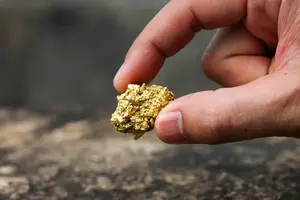
Au - Altın
Altın sıklıkla doğal halde bulunur ve yayılmış sülfitlerle ilişkili veya bunlarla birlikte bulunur. Genellikle diğer metal birikintilerinin bir yan ürünü olarak ortaya çıkar.
Yerli altın oldukça iletkendir. Ancak diğer birçok değerli metal gibi çok düşük konsantrasyonlarda oluşur. Bu nedenle iletkenlik altın için kullanılamaz. Tipik olarak jeofizik ilgili mineraller için kullanılır.
**Keşif için öneriler**
IP/Rezistivite araştırması : Altının yayılmış sülfürlerle ilişkili olması durumunda.
TDEM, FDEM ve gravimetrik araştırmalar : Masif sülfür yataklarının yan ürünü olarak altın bulunursa.
Manyetik ve spektrometri araştırmaları : Bölgesel ölçekte, litolojilerin ve yapıların haritalandırılması. Yerel olarak yataklardaki alterasyon ve zenginleşmenin haritasını çıkarmak.
Not: Yukarıdaki bilgiler yalnızca bilgilendirme amaçlı verilmiştir. Her arama projesi kendine özgü jeofizik uygulamalarına göre incelenmelidir.
Anorthosite (Fe-Ti)
Anortozitlerle İlişkili Demir-Titanyumun Jeofizik ve Araştırılması
Fe-Ti oksit yatakları, anortozitler gibi mafik sokulumlarla olan ilişkileriyle bilinmektedir.
**Bölgesel tanımlama**
Gravimetri: Fe-Ti bakımından zenginleşmiş cevher genellikle çevresindeki granitik veya gnaysik kayalarla yoğunluk açısından bir kontrast sunar. Bu nedenle gravite verileri pozitif bir yerçekimi anomalisi sergiler.
Manyetizma: Fe-Ti zaman zaman titaniferli manyetit bakımından zengin tabakalı cevherleşme ile ilişkilendirilir. Genellikle cevher alanları manyetik anomalilerle ilişkilidir.
**Detay arama**
Manyetizma: Fe-Ti, yarı masif ila masif titanlı ilmenit veya manyetit merceklerle ilişkilidir. Manyetit mercekleri güzel bir manyetik anomali gösterir.
Gravimetri: Bazı birikintiler, 4,5’i aşabilen yoğunluğa sahip, yarı kütleden masif oksit merceklerine kadar değişir. Ayrıntılı bir yerçekimi araştırması birikintilerin üzerinde güçlü bir yanıt verir. Ayrıca mineralize merceklerin tonajına ilişkin bir tahmin de verebilir.
Not: Yukarıdaki bilgiler yalnızca bilgilendirme amaçlı verilmiştir. Her arama projesi kendine özgü jeofizik uygulamalarına göre incelenmelidir.
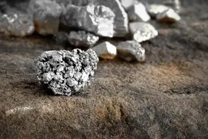
Ag - Gümüş
Gümüş sıklıkla doğal halde bulunur ve yayılmış sülfitlerle ilişkili veya bunlarla birlikte bulunur. Genellikle diğer metal birikintilerinin bir yan ürünü olarak ortaya çıkar.
Yerli gümüş, tüm metaller arasında en yüksek elektrik iletkenliklerinden birine ve en yüksek termal iletkenliklerden birine sahiptir. Ancak doğal gümüş büyük konsantrasyonlarda oluşmaz ve özellikleri gümüşü araştırmak için kullanılamaz.
Tipik olarak jeofizik, ilişkili mineralleri tespit etmek için kullanılır.
**Keşif için öneriler**
IP/Rezistivite araştırması : Gümüşün yayılmış sülfürlerle ilişkili olması durumunda.
TDEM, FDEM ve gravimetrik araştırmalar : Masif sülfür yataklarının yan ürünü olarak gümüş bulunursa.
Manyetik ve spektrometri araştırmaları : Bölgesel olarak, litolojilerin ve yapıların haritalandırılması ve yerel olarak yataklardaki değişim ve zenginleşmenin haritalandırılması.
Not: Yukarıdaki bilgiler yalnızca bilgilendirme amaçlı verilmiştir. Her arama projesi kendine özgü jeofizik uygulamalarına göre incelenmelidir.
💬 Need help?
SAGTech Geophysics
Hello 👋, welcome to SAGTech Geophysics. === How can we help you?