Using geophysical parameters for methods to address geotechnical problems has become one of the essential techniques of geotechnical engineering.
SAGTech Geophysics provides multidisciplinary geophysical engineering services to its clients for the design, planning, construction and operation of superstructures or substructures in civil and geotechnical projects using up-to-date geophysical techniques.
Geotechnical Investigation Areas
- Characterization of lithology
- Determination of groundwater depths
- Determination of bedrock topography and structure
- Identification of areas with high potential liquefaction potential
- Determination of rock properties in the field
- Mapping of karstic areas close to the surface
- Mapping of construction foundation integrity
- Investigation of dam and embankment integrity
- Assessment of landslide hazards
- Mapping concrete and asphalt properties
- Detection of rebar and pipes
- Post-earthquake damage assessment
Geophysical Methods We Use
- Micro Gravity
- Seismic (MASW/REMI/SASW)
- Passive Seismic (HVSR/SPAC/FK2D)
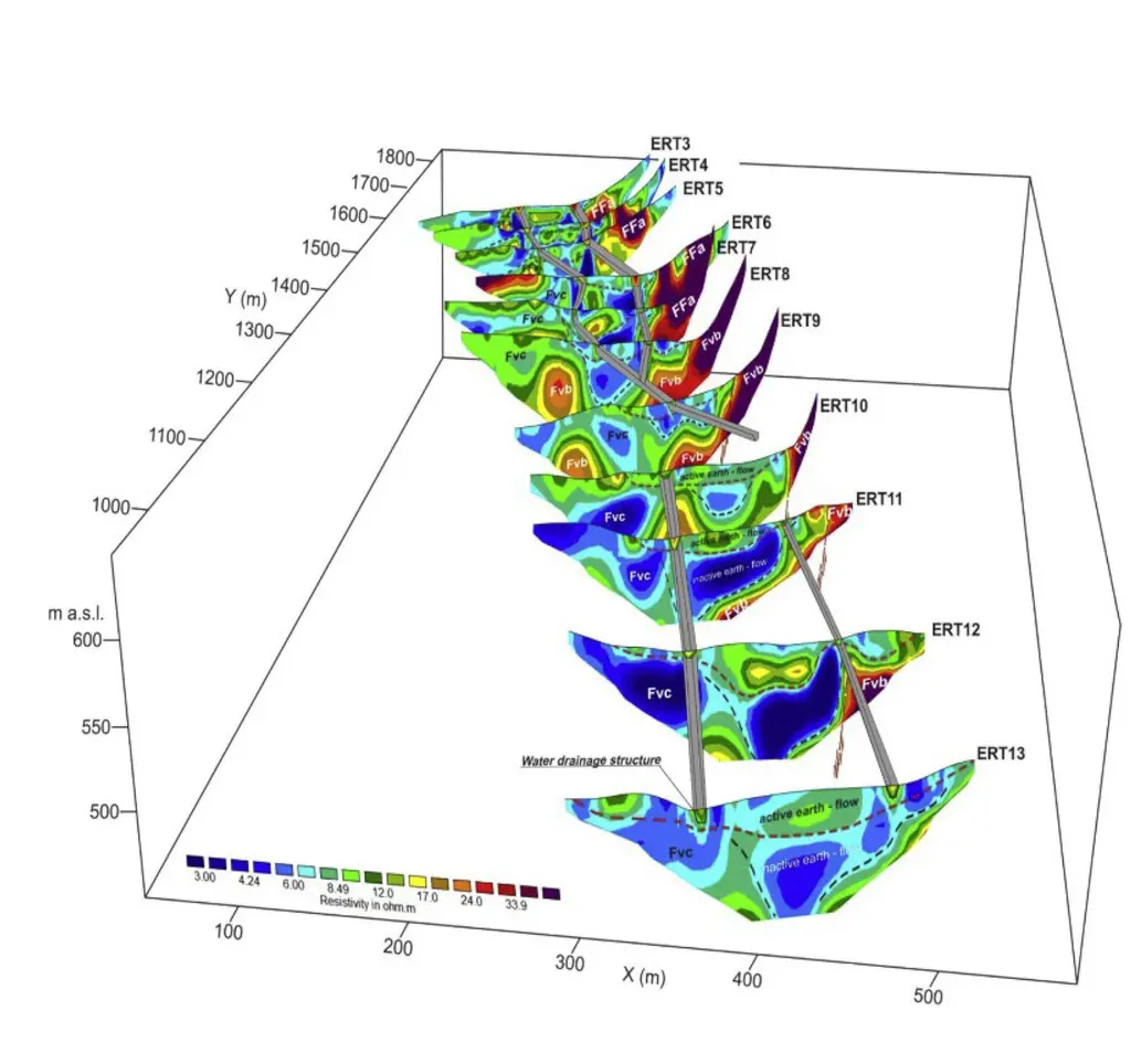
- SP and Resistivity (ERT/VES)
- Electromagnetic (TDEM/TEM)
- Ground Penetrating Radar (GPR)
- Geophysical Seismic Well Logging (PS Log, Cross Hole, Up Hole, Down Hole)